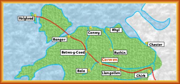
| Below is a rather diagramatical map showing the location of
Corwen in the area covered by the relatively "new"
unitary authorities of Sir Ddinbych (Denbighshire), Gwynedd, Môn (Anglesey),
Conwy, and Sir Fflint (Flintshire). The red line is the A5 trunk road, originally
the route of the Irish Mail from London to Holyhead, nowadays the tourist route to
Snowdonia the coast and Anglesey or the main route for one of the Irish Ferry
crossings. |
|
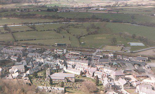
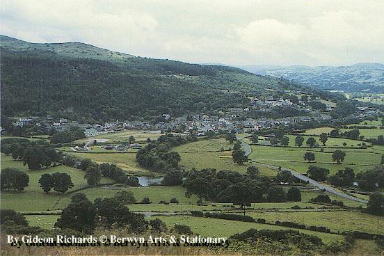
| On your way for the ferry or one of the main tourist areas you may well have passed
through Corwen without noticing anything in particular about the place. It sits there on the banks of the Dee, at the foot of the Berwyns, slap bang in the middle of a region abounding in castles, preserved railways, areas "of outstanding natural beauty", terrain suitable for climbing, walking, watersports, mountain bikes, places for fishing, wildlife observation etc. etc. but there is nothing much which tells you about Corwen itself, unless you stop and walk around.
|
|
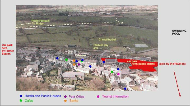
(This links to a version of the photo at the start of the introduction with significant facilities indicated, one of the hostelries is currently closed, the largest has been recently taken over and should be residential again shortly.)
|
 |
|
 |
 |
As this site is a development area I would be grateful if you would please email any comments or questions. |